Urban areas around the globe are increasingly susceptible to the impacts of climate change, particularly the phenomenon known as the urban heat island effect.
This effect results in city temperatures being significantly higher than surrounding rural areas due to factors such as heat absorption and radiation from materials like concrete and asphalt, emissions from vehicles and air-conditioning units, and disrupted wind flow caused by tall buildings.
In addressing this challenge, cities worldwide are adopting innovative measures. Notably, Chicago and Los Angeles have implemented different projects to mitigate urban heat. Chicago, with a history of severe heatwaves, has transformed over 500 rooftops into green spaces. These vegetated roofs not only provide natural insulation but also cool the environment through evaporative cooling. In Los Angeles, efforts have been made to cover roads with a solar-reflective coating, aimed at decreasing the heat absorbed by the asphalt.
However, a profound hurdle in tackling urban heat lies in the scarcity of detailed temperature data across city landscapes. This dilemma became apparent to Jay Sadiq, an entrepreneur from Abu Dhabi. While in pursuit of a project to develop heat-reducing asphalt, Sadiq realized that current data on urban temperature was inadequate. Consequently, he launched FortyGuard, a company leveraging artificial intelligence (AI) and advanced data analytics to create comprehensive temperature models for urban areas.

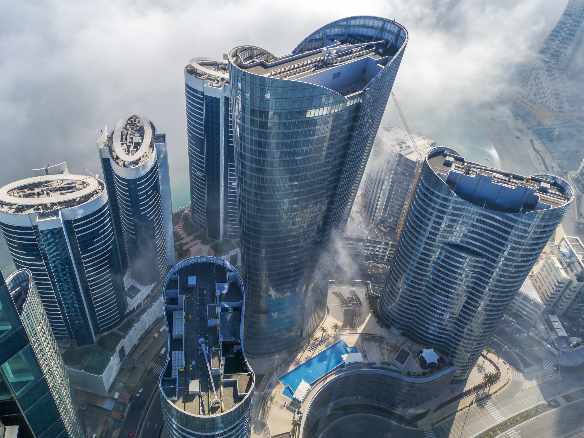
Abu Dhabi Al Reem island towers.
Based in Abu Dhabi and San Jose, FortyGuard collects a significant amount of data—about 32 billion data points daily—though the sources remain undisclosed due to competitive reasons. The company employs AI to consider diverse factors such as city elevation, vegetation, and atmospheric conditions, offering detailed insights beyond just air temperature readings.
FortyGuard’s technology has already seen applications in projects like Masdar City, an experimental sustainable city in the UAE. Here, the company provided detailed temperature maps to identify hotspots, guiding the strategic placement of trees and water features to lower temperatures. The company’s data, boasting an 89% accuracy for certain U.S. cities, models temperatures with a granularity of every 10 square meters, providing valuable guidance for urban planners and developers.
The increased availability of detailed urban heat data also presents opportunities for technological integration. Jay Sadiq envisions embedding FortyGuard’s insights into platforms such as real estate and mapping services. This could enable potential homeowners to assess neighbourhoods based on temperature, or athletes to chart cooler routes for their activities.
The relevance of this technology is echoed in concurrent initiatives by prominent companies. Zillow, a major real estate platform in the U.S., recently began offering listings with comprehensive climate risk data, including wildfire and heat risk. Similarly, Google has introduced a Heat Resilience tool designed to utilise AI in assessing heat risks across cities using aerial and satellite imagery.
Experts in urban climatology, such as Professor James Voogt of the University of Western Ontario and Associate Professor Chao Ren from the University of Hong Kong, highlight the growing demand for precise urban temperature data. They caution, however, that the effectiveness of such initiatives depends on the quality of data sources and the methodologies used in AI training.
The implications of urban heat data extend beyond technological applications to practical city management and planning. Some areas excel in utilising this information, while others lag. As cities continue to explore ways to manage the escalating effects of climate change, the role of technology in providing reliable data and solutions will be essential for future urban resilience.


